Colorado Street Bridge
- Historic bridge
- In Pasadena, California
- On Route 66
- National Register of Historic Places
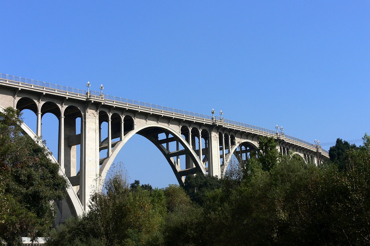
The Colorado Street Bridge in Pasadena, CA, is a 1913 concrete arch bridge that carries Colorado Boulevard about 150 feet above the Arroyo Seco at its highest point. It crosses the ravine in a curve, lined with ornate railings and lamp posts. Route 66 traffic used it until the Arroyo Seco Parkway took over in 1940. Listed on the National Register, it is still a working two-lane street with sidewalks.
What is Colorado Street Bridge?
The bridge is a reinforced-concrete arch bridge in Beaux Arts style, about 1,468 feet long and carried on concrete arches. At its highest it stands about 150 feet above the floor of the Arroyo Seco, the ravine that separates Pasadena from Eagle Rock and Glendale, which lie west of it. Decorative railings and lamp posts line the deck, and the roadway bends in a clear curve partway across.
History of Colorado Street Bridge
Before 1913, travelers crossed on the lower Scoville bridge, which meant dropping into the ravine and climbing back out. The new span was designed by the Kansas City engineering firm Waddell & Harrington and built by John Drake Mercereau's Los Angeles construction company. Mercereau changed the plan and moved the footings onto firmer ground in the arroyo, giving the bridge its curve. Work began in July 1912; on December 13, 1913, Pasadena residents celebrated the opening by driving decorated cars across.
Route 66 later used the bridge until the Arroyo Seco Parkway became the route in 1940. It was listed on the National Register of Historic Places in 1981, and it has also been designated a Historic Civil Engineering Landmark. The 1989 Loma Prieta earthquake closed it for a seismic retrofit and restoration, and it reopened in December 1993 with its original details and a higher safety railing.
Visiting Colorado Street Bridge: tips
The bridge is part of Colorado Boulevard, so driving across it follows a piece of the old Route 66 through Pasadena. Walking the sidewalk gives a closer look at the railings, the lamp posts and the drop into the arroyo; a stroll across and back makes a short stop. Tall fencing, put up by the city in 2018 as a temporary measure, lines the walkways while a permanent barrier is still being designed. The preservation group Pasadena Heritage has held summer Bridge Parties on the bridge.
Practical info
- Address
- 504 W Colorado Blvd, Pasadena, CA 91105
- On site & nearby
Sources: OpenStreetMap contributors (ODbL) · Wikidata · official site — may be outdated. Suggest a fix
Where to eat near Colorado Street Bridge
All diners on Route 66 →


On the map
Full mapColorado Street Bridge with the 6 closest stops and places to eat (fork and knife). Tap a marker for details.
Tap a dot to see that stop here.
Stops near Colorado Street Bridge
All of California.jpg/500px-Norton_Simon_Museum_Pasadena_CA_(51081778692).jpg)
0.4 mi from Colorado Street Bridge

0.4 mi from Colorado Street Bridge

0.4 mi from Colorado Street Bridge

0.9 mi from Colorado Street Bridge

1.0 mi from Colorado Street Bridge

1.4 mi from Colorado Street Bridge
Questions about Colorado Street Bridge
Is the Colorado Street Bridge on Route 66?
It was. Route 66 crossed the Arroyo Seco on this bridge until 1940, when the Arroyo Seco Parkway became the route between Los Angeles and Pasadena. The bridge still carries Colorado Boulevard.
Can you walk across the Colorado Street Bridge?
Yes. The bridge has sidewalks beside its two traffic lanes. Tall fencing that the city added in 2018 lines the walkways.
How old is the Colorado Street Bridge?
It opened in December 1913 after about 18 months of work. It closed in 1989 for an earthquake retrofit and restoration and reopened in December 1993.
Own or run Colorado Street Bridge? Send us a photo or a correction.