
Route 66 in California: Map, Towns & Things to See
- 182 stops
- 11 categories
The planner builds a day-by-day plan from the California line (east) to the California line (west) — about 333 mi.
Towns in California (9)
East to west. Tap a town for its guide and stops.
Kinds of stops in California
- Museums 74
- Nature & parks 56
- Art & landmarks 12
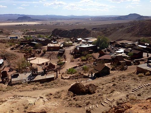
- Ghost towns 11
- Historic buildings 9
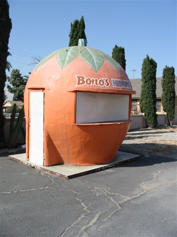
- Retro roadside stops 7
- Historic hotels 5
- Route 66 sites 3
- Historic theaters 2
- Historic districts 2
- Historic bridges 1
Where to eat: 13 classic diners and restaurants on or near Route 66 in California. See them →
California's stretch of Route 66 runs about 315 miles, from the Colorado River at Needles across the Mojave Desert, over Cajon Pass and through the towns at the foot of the San Gabriel Mountains to the Pacific at Santa Monica. It holds the road's two extremes in one state: empty desert with ghost towns and craters, then the museums and traffic of greater Los Angeles. Our map has 182 stops in California.
182 of 182 stops on the map
Tap a dot to see that stop here.
What to see on Route 66 in California
Needles has the El Garces Hotel, a 1908 Harvey House by the tracks. West of town the old road crosses Mojave Trails National Monument past near-empty stops like Essex and Amboy, where Roy's Motel and Cafe and its tall sign face Amboy Crater. Bagdad and Ludlow lead on toward Barstow, with the old silver town of Calico just north. Victorville has the California Route 66 Museum. Past Cajon Pass, look for the Cucamonga Service Station and the Norton Simon Museum in Pasadena. In Los Angeles, the Petersen Automotive Museum and the La Brea Tar Pits sit close to the old road on the way to the ocean.
By kind, our 182 California stops include 74 museums, 56 parks and nature spots, 12 landmarks and roadside art pieces, 11 ghost towns and 9 historic buildings.
Much of the desert road follows the older National Old Trails Road, beside a railroad whose sidings were named in alphabetical order: Amboy, Bagdad, Cadiz, Danby, Essex and so on. Most of those sidings are empty now, and the ghost towns along this stretch are what is left of them.
Towns, overnight stops and how long to allow
Route 66 towns in California, east to west: Needles, Amboy, Ludlow, Barstow, Victorville, San Bernardino, Pasadena, Los Angeles and Santa Monica. Barstow and Santa Monica have the widest choice of motels for the night; Needles, Victorville, San Bernardino and Pasadena suit a shorter day.
Plan two days: one across the desert and one through the Inland Empire and Los Angeles to Santa Monica. In the Mojave, fill up and carry water: services are far apart between Needles and Barstow, and summer heat is extreme.
Best time to drive Route 66 in California
October to April is the comfortable season in the desert; from June to September the Mojave often passes 100°F, so cross it early in the day. The Los Angeles end is mild all year, though traffic on the old boulevards is heavy at rush hour.
Museums in California (74)
Back to top ↑


More museums in California 68
- Inland Empire Museum of ArtUpland
- Pacific Asia MuseumPasadena
- Armory Center for the ArtsPasadena
- Norton Simon MuseumPasadena
- Raymond M. Alf Museum of PaleontologyClaremont
- Finnish Folk Art MuseumPasadena
- Pasadena Museum of HistoryPasadena
- The Huntington Library, Art Museum, and Botanical GardensSan Marino
- Southwest Museum of the American IndianLos Angeles
- The Bunny MuseumPasadena
- Museum of Neon ArtGlendale
- Heritage Square MuseumLos Angeles
- Autry Museum of the American WestLos Angeles
- VelveteriaLos Angeles
- Wally Parks NHRA Motorsports MuseumPomona
- The BroadLos Angeles
- Museum of Contemporary Art, Los AngelesLos Angeles
- Italian American Museum of Los AngelesLos Angeles
- LA Plaza de Cultura y ArtesLos Angeles
- Chinese American MuseumLos Angeles
- Grammy MuseumLos Angeles
- Japanese American National MuseumLos Angeles
- Bob Hope Patriotic HallLos Angeles
- Travel Town MuseumLos Angeles
- Warner Bros. MuseumBurbank
- American Museum of Ceramic ArtPomona
- Lanterman HouseLa Cañada Flintridge
- Institute of Contemporary Art, Los AngelesLos Angeles
- Doctors HouseGlendale
- Martial Arts History MuseumGlendale
- Museum of ToleranceLos Angeles
- Academy Museum of Motion PicturesLos Angeles
- A+D MuseumLos Angeles
- Petersen Automotive MuseumLos Angeles
- Los Angeles County Museum of ArtLos Angeles
- Pavilion for Japanese ArtLos Angeles
- Hollyhock HouseLos Angeles
- Craft ContemporaryLos Angeles
- Los Angeles Municipal Art GalleryLos Angeles
- Annenberg Space for PhotographyLos Angeles
- Pickford Center for Motion Picture StudyLos Angeles
- Los Angeles Fire Department Museum and MemorialLos Angeles
- EdgemarSanta Monica
- Marciano Art FoundationLos Angeles
- Psychiatry: An Industry of Death MuseumLos Angeles
- Museum of DeathLos Angeles
- Museum of FlyingSanta Monica
- Hammer MuseumLos Angeles
- Hollywood MuseumLos Angeles
- Hollywood Wax MuseumLos Angeles
- Venice Heritage MuseumLos Angeles
- Bhagavad-gita MuseumLos Angeles
- Museum of Jurassic TechnologyLos Angeles
- Hollywood Heritage MuseumLos Angeles
- Fowler Museum at UCLALos Angeles
- Franklin D. Murphy Sculpture GardenLos Angeles
- Getty CenterLos Angeles
- J. Paul Getty MuseumLos Angeles
- Wende MuseumCulver City
- Getty VillaLos Angeles
- USC Fisher Museum of ArtLos Angeles
- Natural History Museum of Los Angeles CountyLos Angeles
- Lucas Museum of Narrative ArtLos Angeles
- California Science CenterLos Angeles
- California African American MuseumLos Angeles
- Wallis Annenberg BuildingLos Angeles
- Mojave River Valley MuseumBarstow
- Desert Discovery CenterBarstow
Nature & parks in California (56)
Back to top ↑
.JPG/500px-Pisgah_Crater_(25-10-2014).JPG)



More nature & parks in California 50
- Eagle PeakNeedles
- Sacramento MountainsNeedles
- Piute MountainsNeedles
- Little Piute MountainsNeedles
- Marble MountainsAmboy
- Mitchel RangeBarstow
- Newberry MountainsBarstow
- Waterman HillsBarstow
- Horsethief CanyonHesperia
- Bell MountainApple Valley
- Silver MountainVictorville
- Ord MountainsVictorville
- Deep Creek Hot SpringsApple Valley
- Sawpit CanyonCrestline
- Potato MountainSan Bernardino
- Devil CanyonSan Bernardino
- Monument PeakCrestline
- Etiwanda FallsSan Bernardino
- Mount JurupaJurupa Valley
- Jurupa MountainsJurupa Valley
- Cajon CanyonSan Bernardino
- Cucamonga PeakSan Bernardino
- San Timoteo CanyonRedlands
- Los Angeles County Arboretum and Botanic GardenArcadia
- South HillsGlendora
- Rio de Los Angeles State ParkLos Angeles
- Huntington Desert GardenSan Marino
- Desert Garden ConservatorySan Marino
- Little Santa Anita CanyonSierra Madre
- Arroyo SecoLos Angeles
- Griffith Park ZooLos Angeles
- Fish Canyon FallsDuarte
- Los Angeles ZooLos Angeles
- Gen. Charles S. Farnsworth County ParkAltadena
- Selig ZooLos Angeles
- Eaton CanyonAltadena
- Universal City ZooUniversal City
- Descanso GardensLa Cañada Flintridge
- Monrovia PeakPasadena
- Gay's Lion FarmEl Monte
- San Jose HillsPasadena
- Elephant HillPomona
- Heal the Bay AquariumSanta Monica
- Mildred E. Mathias Botanical GardenLos Angeles
- Virginia Robinson GardensBeverly Hills
- Temescal Canyon, Los Angeles CountyLos Angeles
- Coldwater CanyonLos Angeles
- Kenneth Hahn State Recreation AreaLos Angeles
- Topanga State ParkLos Angeles
- Rainbow BasinBarstow
Art & landmarks in California (12)
Back to top ↑.jpg/500px-Adobe_(1_of_1).jpg)
_de_Jos%C3%A9_Clemente_Orozco_en_Pomona_College.jpg/500px-Prometheus_(1930)_de_Jos%C3%A9_Clemente_Orozco_en_Pomona_College.jpg)
.jpg/500px-Elmer's_Bottle_Tree_Ranch_(15608759528).jpg)


More art & landmarks in California 6
- CACTUSYermo
- Liberty Sculpture ParkYermo
- Brackett ObservatoryClaremont
- Robert Brownlee ObservatoryLake Arrowhead
- Santa's VillageLake Arrowhead
- Chicken BoyLos Angeles
Ghost towns in California (11)
Back to top ↑


.jpg/500px-Ludlow_Cafe_-_California_Ghost_Town_(8327475273).jpg)
More ghost towns in California 5
- ChamblessChambless
- RagtownRagtown
- Lane's CrossingLane's Crossing
- PolitanaPolitana
- La PlacitaLa Placita
Historic buildings in California (9)
Back to top ↑


More historic buildings in California 3
- Sam and Alfreda Maloof CompoundRancho Cucamonga
- Frankish BuildingOntario
- Pomona City StablesPomona
Retro roadside stops in California (7)
Back to top ↑


.jpg/500px-The_New_Corral_Motel_-_Route_66_(9383348965).jpg)
More retro roadside stops in California 1
- Topanga Ranch MotelMalibu
Historic hotels in California (5)
Back to top ↑
.jpg/500px-San_Dimas_Hotel_(Walker_House).jpg)

Route 66 sites in California (3)
Back to top ↑

Historic theaters in California (2)
Back to top ↑

Historic districts in California (2)
Back to top ↑

Historic bridges in California (1)
Back to top ↑
Route 66 in California: questions
Where does Route 66 end?
In Santa Monica, on the Pacific coast. Most drivers finish at Santa Monica Pier, where an "End of the Trail" sign stands; the highway's official end was a few blocks inland, at Lincoln and Olympic Boulevards.
How many miles of Route 66 are in California?
About 315 miles, depending on which of the road's alignments you follow. The whole road, from Chicago to Santa Monica, is about 2,448 miles long.
What towns does Route 66 go through in California?
The main stops, east to west, are Needles, Amboy, Ludlow, Barstow, Victorville, San Bernardino, Pasadena, Los Angeles and Santa Monica. Smaller places on the road include Essex, Chambless, Amboy, Bagdad, Ludlow, Newberry Springs, Daggett, Rancho Cucamonga, Upland and Monrovia.
Can you still drive Route 66 in California?
Mostly. The National Trails Highway still crosses the Mojave, though stretches east of Amboy have been closed at times for bridge repairs, so check road conditions before you go. West of Barstow the old road runs through Victorville, over Cajon Pass and along city boulevards to the coast.