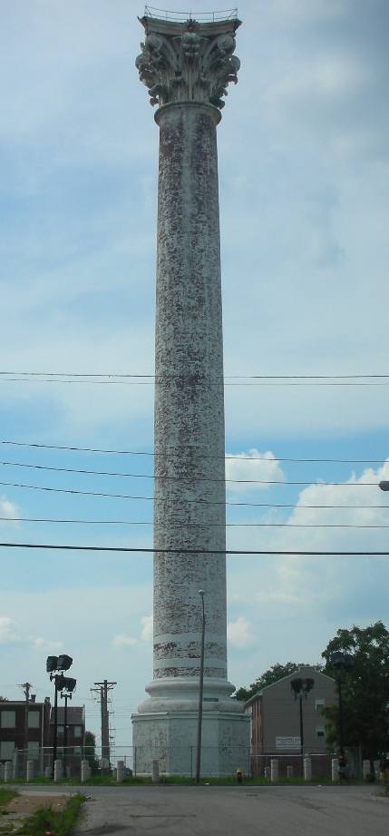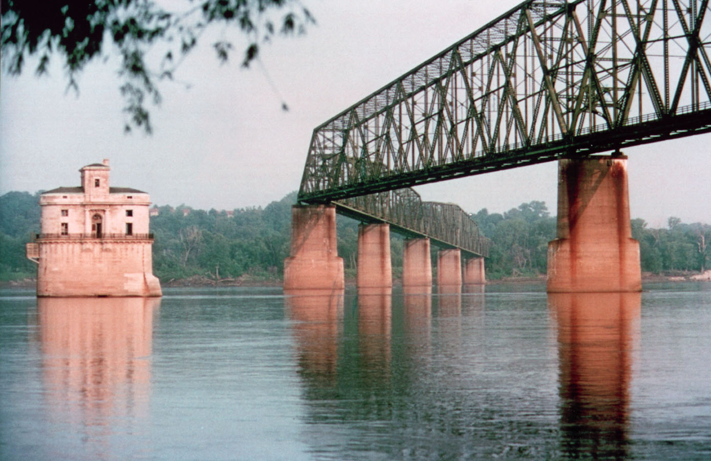
Chain of Rocks Bridge, St. Louis, MO
Route 66 · State 2 of 8

Route 66 in Missouri: Map, Towns & Things to See

  • 124 stops
  • 12 categories
Photo: Chain of Rocks Bridge · Wikimedia Commons
Plan a trip through Missouri

The planner builds a day-by-day plan from the Missouri line (east) to the Missouri line (west) — about 346 mi.

Towns in Missouri (7)

East to west. Tap a town for its guide and stops.

Kinds of stops in Missouri

Where to eat: 2 classic diners and restaurants on or near Route 66 in Missouri. See them →

Missouri's stretch of Route 66 runs about 315 miles from St. Louis to the Kansas line west of Joplin. It climbs out of the Mississippi valley into the Ozark hills, where the old road winds beside Interstate 44 past caves, rivers, small-town motels and a string of roadside curiosities. Our map shows 124 stops in Missouri, from big-city landmarks to near-forgotten crossroads.

124 of 124 stops on the map

Tap a dot to see that stop here.

What to see on Route 66 in Missouri

Begin at the Gateway Arch and the Chain of Rocks Bridge, the old Mississippi crossing with a bend in the middle that is now open only to people on foot and bikes. Route 66 State Park covers the site of the lost town of Times Beach. Farther west, Meramec Caverns has been advertised on billboards for generations, and the Wagon Wheel Motel in Cuba has rented rooms since 1938. Uranus near St. Robert is pure roadside fun. Lebanon keeps the neon Munger-Moss Motel, Springfield has a Steak 'n Shake on the National Register, and Carthage has the Boots Motel and the 66 Drive-In, which still shows movies. Missouri also has the most ghost towns in our data, though many are little more than a name on an old map.

By kind, our 124 Missouri stops include 29 historic buildings, 26 parks and nature spots, 22 ghost towns, 14 museums and 9 retro roadside stops.

Much of Missouri's Route 66 follows an older path, the Wire Road, named for the telegraph line that ran beside it in the 1800s. Later, long pieces of the highway became frontage roads for Interstate 44, which is why the old road so often runs within sight of the new one.

Towns, overnight stops and how long to allow

Route 66 towns in Missouri, east to west: St. Louis, Cuba, Rolla, Lebanon, Springfield, Carthage and Joplin. St. Louis, Springfield and Joplin have the widest choice of motels for the night; Cuba, Rolla, Lebanon and Carthage suit a shorter day.

Two days is comfortable: one from St. Louis to Rolla or Lebanon with a cave stop, and one on to Joplin. The old road changes names often here, from outer roads beside the interstate to lettered county routes and city streets, so keep a map or the trip planner handy.

Best time to drive Route 66 in Missouri

Spring and fall are the best times in the Ozarks: dogwoods bloom in April, and the wooded hills turn red and gold in October. Summer is hot and humid but good for swimming and canoeing on the Meramec; in winter, the caves stay at the same mild temperature all year, which makes them a good cold-day stop.

Historic buildings in Missouri (29)

Back to top ↑
Maj. Gen. William S. Harney Summer Home in Sullivan, MO

Maj. Gen. William S. Harney Summer Home

Sullivan, Missouri · 0.6 mi from Route 66

An 1856 sandstone house in Sullivan that became an Army general's summer retreat, now a house museum.

Historic buildingPhoto credit
Old Stagecoach Stop in Waynesville, MO

Old Stagecoach Stop

Waynesville, Missouri · 0.1 mi from Route 66

A historic hotel on the Waynesville town square that has gone by five different names over its long life.

Historic buildingPhoto credit
Newman Brothers Building in Joplin, MO

Newman Brothers Building

Joplin, Missouri · 0.1 mi from Route 66

A Chicago School department store building in downtown Joplin, now home to city offices.

Historic buildingPhoto credit
St. Louis and San Francisco Railroad Building in Joplin, MO

St. Louis and San Francisco Railroad Building

Joplin, Missouri · on Route 66

A nine-story railroad station and office tower from 1913 that still anchors downtown Joplin.

Historic buildingPhoto credit
Bonnie & Clyde Garage Apartment in Joplin, MO

Bonnie & Clyde Garage Apartment

Joplin, Missouri · 2.2 mi from Route 66

A modest late-1920s garage apartment in Joplin whose name recalls the outlaws Bonnie and Clyde.

Historic buildingPhoto credit
Elijah Thomas Webb Residence in Webb City, MO

Elijah Thomas Webb Residence

Webb City, Missouri · on Route 66

A towered Queen Anne brick mansion from about 1891, one of Webb City's rare survivors of its kind.

Historic buildingPhoto credit

Nature & parks in Missouri (26)

Back to top ↑
Gateway Arch National Park in St. Louis, MO

Gateway Arch National Park

St. Louis, Missouri · 0.7 mi from Route 66

The nation's smallest national park holds the Arch, the Old Courthouse and a riverfront museum.

Nature & parksPhoto credit
Endangered Wolf Center in Eureka, MO

Endangered Wolf Center

Eureka, Missouri · 0.1 mi from Route 66

A wolf conservation center founded by Marlin Perkins, where rare wolves are bred for return to the wild.

Nature & parksPhoto credit
Route 66 State Park near St. Louis, MO

Route 66 State Park

St. Louis, Missouri · 0.1 mi from Route 66

A riverside park on the site of the lost town of Times Beach, named for the old highway.

Nature & parksPhoto credit
Castlewood State Park, Missouri

Castlewood State Park

Castlewood, Missouri · 1.6 mi from Route 66

A big riverside state park on the Meramec, close to St. Louis and a few miles from the old road.

Nature & parksPhoto credit
Meramec Caverns in Sullivan, MO

Meramec Caverns

Sullivan, Missouri · 1.9 mi from Route 66

Missouri's most-visited cave, a 4.6-mile system advertised by dozens of billboards along I-44.

Nature & parksPhoto credit
Battle of Carthage State Historic Site, Missouri

Battle of Carthage State Historic Site

Carthage, Missouri · 0.5 mi from Route 66

A small state-run field in Carthage that preserves part of an 1861 battle from the start of the Civil War.

Nature & parksPhoto credit

Ghost towns in Missouri (22)

Back to top ↑
Times Beach, Missouri

Times Beach

Times Beach, Missouri · 0.4 mi from Route 66

A Route 66 town emptied by dioxin in 1983, its land now a state park that remembers the old road.

Ghost townPhoto credit

Clementine

Clementine, Missouri · on Route 66

A tiny community right on the old Route 66 alignment, about fourteen miles southwest of Rolla.

Ghost town

Hooker

Hooker, Missouri · 0.2 mi from Route 66

A roadside town built on a newer line of Route 66, now gone except for its cemetery.

Ghost town

Arlington

Arlington, Missouri · 0.1 mi from Route 66

A near-empty railroad and Route 66 town on the Little Piney, left at a dead end when I-44 bypassed it.

Ghost town

Sampson

Sampson, Missouri · 0.1 mi from Route 66

A tiny crossroads community in Webster County, between Niangua and Conway, northeast of Marshfield.

Ghost town

Holman

Holman, Missouri · on Route 66

A short-lived Webster County post-office town that once had its own schoolhouse, northeast of Springfield.

Ghost town

More ghost towns in Missouri 16

Museums in Missouri (14)

Back to top ↑
National Blues Museum in St. Louis, MO

National Blues Museum

St. Louis, Missouri · 0.2 mi from Route 66

A former St. Louis museum of blues history and live music, now closed, a short walk from the Gateway Arch.

MuseumPhoto credit
City Museum in St. Louis, MO

City Museum

St. Louis, Missouri · 0.3 mi from Route 66

A St. Louis museum built from salvaged building parts and machinery inside a former shoe company building.

MuseumPhoto credit
Saint Louis Art Museum in St. Louis, MO

Saint Louis Art Museum

St. Louis, Missouri · 3.4 mi from Route 66

A big art museum in Forest Park with works from across the world and centuries, free to enter.

MuseumPhoto credit
National Museum of Transportation in St. Louis, MO

National Museum of Transportation

St. Louis, Missouri · 2.0 mi from Route 66

Big locomotives, vintage cars and aircraft on 42 acres, plus a railroad tunnel dug in 1853.

MuseumPhoto credit

Joplin History and Mineral Museum

Joplin, Missouri · 0.2 mi from Route 66

Lead and zinc ore, old mining gear and Joplin history under one roof in Schifferdecker Park.

Museum

Route 66 Car Museum

Springfield, Missouri · on Route 66

About 70 cars from one owner's collection, a Batmobile among them, on Route 66 in Springfield, MO.

Museum

Retro roadside stops in Missouri (9)

Back to top ↑
Coral Court Motel in Marlborough, MO

Coral Court Motel

Marlborough, Missouri · 0.5 mi from Route 66

A lost Route 66 landmark: the streamlined Coral Court Motel, demolished in 1995 despite a fight to save it.

Retro roadsidePhoto credit
Wagon Wheel Motel, Café and Station in Cuba, MO

Wagon Wheel Motel, Café and Station

Cuba, Missouri · on Route 66

A Tudor Revival Route 66 motel in Cuba that has rented rooms without a break since 1938.

Retro roadsidePhoto credit
Munger-Moss Motel in Lebanon, MO

Munger-Moss Motel

Lebanon, Missouri · on Route 66

A Lebanon motel with roots in a 1930s Route 66 sandwich shop that moved here after World War II.

Retro roadsidePhoto credit
Route 66 Steak 'n Shake in Springfield, MO

Route 66 Steak 'n Shake

Springfield, Missouri · 0.6 mi from Route 66

A Springfield Steak 'n Shake on the old Route 66 path that earned a spot on the National Register.

Retro roadsidePhoto credit
Boots Motel in Carthage, MO

Boots Motel

Carthage, Missouri · on Route 66

A 1939 streamline motor court in Carthage with black glass trim, green neon and a carport for every room.

Retro roadsidePhoto credit
66 Drive-In in Carthage, MO

66 Drive-In

Carthage, Missouri · 0.1 mi from Route 66

A 1949 drive-in theater on Route 66 near Carthage that still shows movies under the stars.

Retro roadsidePhoto credit

More retro roadside stops in Missouri 3

Historic districts in Missouri (7)

Back to top ↑
Rolla Ranger Station Historic District, Missouri

Rolla Ranger Station Historic District

Rolla, Missouri · on Route 66

Five 1930s stone and frame buildings built by the Civilian Conservation Corps for forest rangers.

Historic districtPhoto credit
Carthage Courthouse Square Historic District, Missouri

Carthage Courthouse Square Historic District

Carthage, Missouri · 0.1 mi from Route 66

Downtown Carthage's historic square: 42 old commercial buildings gathered around the county courthouse.

Historic districtPhoto credit
Joplin Downtown Historic District, Missouri

Joplin Downtown Historic District

Joplin, Missouri · on Route 66

Forty-eight historic buildings in Joplin's old business core, from Mission Revival to Art Deco.

Historic districtPhoto credit

Murphysburg Historic District

Joplin, Missouri · 0.1 mi from Route 66

185 historic buildings, from Queen Anne houses to early churches, in a residential corner of Joplin.

Historic district
Fifth and Main Historic District in Joplin, MO

Fifth and Main Historic District

Joplin, Missouri · 0.1 mi from Route 66

Three connected early-1900s buildings on a downtown Joplin corner, now part of a larger district.

Historic districtPhoto credit
St. Peter the Apostle Catholic Church and Rectory in Joplin, MO

St. Peter the Apostle Catholic Church and Rectory

Joplin, Missouri · 1.2 mi from Route 66

A 1906 Gothic Revival church and a 1917 Prairie-style rectory, both built of Carthage limestone.

Historic districtPhoto credit

More historic districts in Missouri 1

Art & landmarks in Missouri (5)

Back to top ↑
Gateway Arch in St. Louis, MO

Gateway Arch

St. Louis, Missouri · 0.7 mi from Route 66

The 630-foot steel arch on the Mississippi is the tallest arch on Earth and the symbol of St. Louis.

Art & landmarksPhoto credit
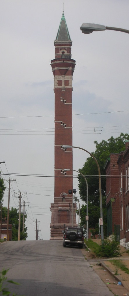
Bissell Street Water Tower in St. Louis, MO

Bissell Street Water Tower

St. Louis, Missouri · 2.1 mi from Route 66

A historic 1886 standpipe known as the New Red, one of three old water towers left in St. Louis.

Art & landmarksPhoto credit
Grand Avenue Water Tower in St. Louis, MO

Grand Avenue Water Tower

St. Louis, Missouri · 2.3 mi from Route 66

The oldest water tower still standing in St. Louis, a standpipe designed by George I. Barnett.

Art & landmarksPhoto credit
Mid America Adventure in Eureka, MO

Mid America Adventure

Eureka, Missouri · 0.5 mi from Route 66

An amusement park opened by Six Flags in 1971, now run under a new name by Enchanted Parks.

Art & landmarksPhoto credit

Baker Observatory

Fair Grove, Missouri · 7.1 mi from Route 66

A Missouri State University observatory set in the countryside just off the old road near Marshfield.

Art & landmarks

Historic hotels in Missouri (4)

Back to top ↑
Red Cedar Inn in Pacific, MO

Red Cedar Inn

Pacific, Missouri · on Route 66

A 1930s log roadhouse in Pacific that fed Route 66 travellers and ballplayers, now a visitor center.

Historic hotelPhoto credit
National Bank of Rolla Building, Missouri

National Bank of Rolla Building

Rolla, Missouri · 0.3 mi from Route 66

A 1931 Colonial Revival bank building in Rolla, listed for its role in the town and on Route 66.

Historic hotelPhoto credit
Connor Hotel in Joplin, MO

Connor Hotel

Joplin, Missouri · on Route 66

Site of Joplin's 1908 hotel, which collapsed without warning a day before its planned demolition in 1978.

Historic hotelPhoto credit
Middle West Hotel in Webb City, MO

Middle West Hotel

Webb City, Missouri · on Route 66

An 1883 opera house building, remodeled in 1902, with brick pilasters and limestone trim.

Historic hotelPhoto credit

Route 66 sites in Missouri (3)

Back to top ↑
Uranus Missouri in St. Robert, MO

Uranus Missouri

St. Robert, Missouri · 0.1 mi from Route 66

A tongue-in-cheek roadside stop with a planet-pun name, a self-styled mayor and a record-setting belt buckle.

Route 66 sitePhoto credit
Route 66 Stadium in Springfield, MO

Route 66 Stadium

Springfield, Missouri · 0.4 mi from Route 66

Springfield's minor league ballpark, called Hammons Field until 2026, about a block from St. Louis Street.

Route 66 sitePhoto credit

Route 66 Park

Joplin, Missouri · on Route 66

A downtown Joplin park with giant Route 66 tile murals and a half-car photo prop.

Route 66 site

Archaeological sites in Missouri (2)

Back to top ↑
Sugarloaf Mound in St. Louis, MO

Sugarloaf Mound

St. Louis, Missouri · 2.2 mi from Route 66

The last Native American mound left in St. Louis, the city's oldest human-made structure.

ArchaeologyPhoto credit

Gourd Creek Cave

Rolla, Missouri · 7.4 mi from Route 66

A big Ozark cave near Rolla where ancient campfires left deep ash, and locals once dug for lost gold.

Archaeology

Historic bridges in Missouri (2)

Back to top ↑
Chain of Rocks Bridge in St. Louis, MO

Chain of Rocks Bridge

St. Louis, Missouri · 0.3 mi from Route 66

A Mississippi River crossing with a sharp bend in the middle, once part of Route 66 and now open to walkers.

Historic bridgePhoto credit
Devils Elbow Bridge, Missouri

Devils Elbow Bridge

Devils Elbow, Missouri · on Route 66

A National Register road bridge on old Route 66 near Rolla, MO, beside a campground and a ghost town.

Historic bridgePhoto credit

Historic theaters in Missouri (1)

Back to top ↑

Lyric Live Theater

Newburg, Missouri · 1.9 mi from Route 66

A 1919 brick small-town theater in Newburg that showed movies until 1955 and now hosts live shows.

Historic theater

Route 66 in Missouri: questions

Where did Route 66 cross the Mississippi at St. Louis?

Route 66 used several bridges over the years as its path through St. Louis changed. The best known is the Chain of Rocks Bridge, famous for the bend in its middle; it carried Route 66 traffic for about three decades and is now a walking and cycling bridge.

How many miles of Route 66 are in Missouri?

About 315 miles, depending on which of the road's alignments you follow. The whole road, from Chicago to Santa Monica, is about 2,448 miles long.

What towns does Route 66 go through in Missouri?

The main stops, east to west, are St. Louis, Cuba, Rolla, Lebanon, Springfield, Carthage and Joplin. Smaller places on the road include Pacific, Stanton, Bourbon, St. James, Waynesville and Marshfield.

Can you still drive Route 66 in Missouri?

Yes. Long stretches survive as outer roads beside I-44 and as lettered county routes through the Ozarks, especially between Cuba and Lebanon. A few old bridges are closed, so expect the odd detour back to the interstate.