
Arizona State Route 66
- Route 66 site
- In Peach Springs, Arizona
- 0.2 mi from Route 66
Arizona State Route 66 is the surviving state-run piece of old U.S. 66, passing through Peach Springs, AZ, on its way across three counties: Mohave, Coconino and Yavapai. In 1914 the road was folded into the National Old Trails Highway, and in 1926 it became U.S. 66. After the federal route was retired, this section passed to the state, and today it lets drivers follow the old alignment instead of the interstate.
What is Arizona State Route 66?
SR 66 is an ordinary surface road maintained by the Arizona Department of Transportation. What makes it special is its lineage: it follows pavement that carried Route 66 traffic, and it keeps the number alive on the state map.
The state designation dates from the mid-1980s, when the old federal highway was being broken up.
History of Arizona State Route 66
In 1914 this corridor joined the National Old Trails Highway, one of the early auto roads across the country. In 1926 it was renumbered as U.S. 66. When U.S. 66 left the highway system in 1985, its Arizona pieces went different ways: some were swallowed by Interstate 40, some went to Yavapai County, and some, including this road, became State Route 66.
Visiting Arizona State Route 66: tips
Driving the road is the attraction, so simply choose it over I-40 where you can. In Peach Springs, the Peach Springs Trading Post and the John Osterman Gas Station are both under 1.5 miles away, and Grand Canyon Caverns is about 12 miles off. Fill up in town, since services can be far apart.
On the map
Full mapArizona State Route 66 with the 6 closest stops. Tap a marker for details.
Tap a dot to see that stop here.
Stops near Arizona State Route 66
All of Arizona
1.3 mi from Arizona State Route 66

1.4 mi from Arizona State Route 66
.JPG/500px-Cave_Popcorn_(Grand_Canyon_Caverns).JPG)
12.3 mi from Arizona State Route 66
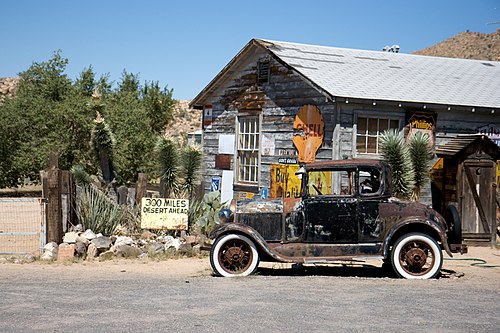
18.9 mi from Arizona State Route 66

23.3 mi from Arizona State Route 66

34.8 mi from Arizona State Route 66
Own or run Arizona State Route 66? Send us a photo or a correction.