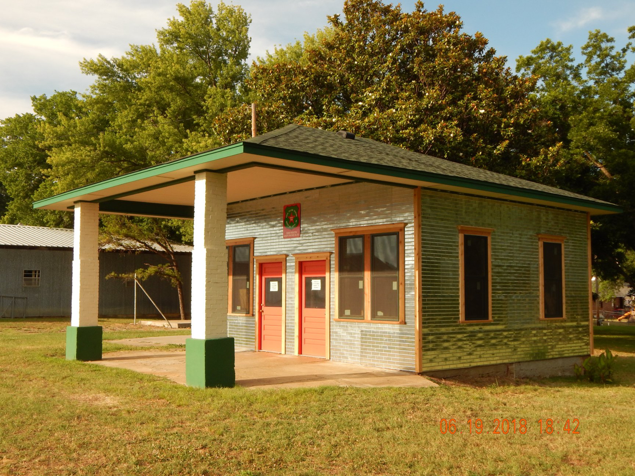
Foyil Filling Station, Oklahoma
- Retro roadside
- In Foyil, Oklahoma
- 0.1 mi from Route 66
- National Register of Historic Places
Foyil's old filling station stands on the earliest path Route 66 took through Foyil, OK, before later realignments moved the highway. It joined the National Register in 2015. The station makes a quick, easy stop on the way to Ed Galloway's Totem Pole Park, the folk-art park about 4 miles away, and it gives a sense of the road as the first Route 66 travelers knew it.
What is Foyil Filling Station?
This is a roadside filling station, the kind of small business that once served drivers on the two-lane highway through small Oklahoma towns. Its value lies in its location: it stands on the original route rather than on a later bypass, so it marks the road as early travelers knew it.
Visiting Foyil Filling Station: tips
Plan on a five- or ten-minute photo stop from the roadside. The site is listed as kid-friendly, and Annie's Diner is about 0.3 mile away if you want a meal in Foyil.
From here, Ed Galloway's Totem Pole Park is about 4 miles away and well worth the short drive. Farther along, Claremore Mound is about 8.5 miles off and the J. M. Davis Arms and Historical Museum about 9.8 miles, so the station fits neatly into a day of stops between Foyil and Claremore.
Practical info
- Address
- 12243 Andy Payne Blvd, Claremore, OK 74017
- Hours
- Open 24 h
- On site & nearby
Sources: OpenStreetMap contributors (ODbL) · Wikidata · official site — may be outdated. Suggest a fix
On the map
Full mapFoyil Filling Station with the 6 closest stops. Tap a marker for details.
Tap a dot to see that stop here.
Stops near Foyil Filling Station
All of Oklahoma
4.0 mi from Foyil Filling Station
.jpg/500px-Claremore_Mound%2C_Claremore%2C_Okla.%2C_U.S.A.%2C_6_miles_northeast_of_Hotel_Will_Rogers_(63055).jpg)
8.5 mi from Foyil Filling Station

9.3 mi from Foyil Filling Station

9.8 mi from Foyil Filling Station

10.0 mi from Foyil Filling Station

10.0 mi from Foyil Filling Station
Own or run Foyil Filling Station? Send us a photo or a correction.