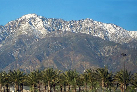
Cucamonga Peak
- Nature & parks
- Near San Bernardino, California
- 7.2 mi from Route 66
Cucamonga Peak ranks among the tallest summits of the San Gabriel range, in San Bernardino County, CA, about 7 miles off the old road. It tops out at 8,862 feet, or 2,701 meters, and lies inside the Cucamonga Wilderness, part of San Bernardino National Forest. For Route 66 travelers, it is one of the high summits framing this part of the drive.
What is Cucamonga Peak?
The peak takes its name from Rancho Cucamonga, the Mexican land grant of the 1800s that spread across the land at its foot. It is protected wilderness, so the setting is rugged and undeveloped.
Visiting Cucamonga Peak: tips
Reaching the summit is a serious mountain hike, so most travelers will enjoy it from the valley. Etiwanda Falls is about 4.4 miles away, and the Sam and Alfreda Maloof Compound about 4.6 miles.
Practical info
- Address
- California
Sources: OpenStreetMap contributors (ODbL) · Wikidata · official site — may be outdated. Suggest a fix
Where to eat near Cucamonga Peak
All diners on Route 66 →.jpg/250px-Magic_Lamp_Inn_(NBY_432829).jpg)
On the map
Full mapCucamonga Peak with the 6 closest stops and places to eat (fork and knife). Tap a marker for details.
Tap a dot to see that stop here.
Stops near Cucamonga Peak
All of California4.4 mi from Cucamonga Peak

4.6 mi from Cucamonga Peak
.jpeg/500px-Potato_Mountain_(197314141).jpeg)
7.3 mi from Cucamonga Peak

7.9 mi from Cucamonga Peak

8.0 mi from Cucamonga Peak
.jpg/500px-Adobe_(1_of_1).jpg)
8.1 mi from Cucamonga Peak
Own or run Cucamonga Peak? Send us a photo or a correction.