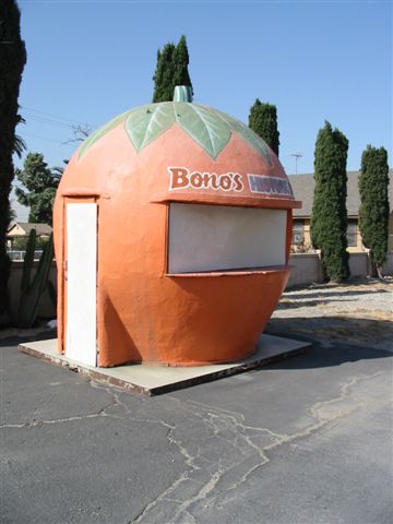
Mount Jurupa in Jurupa Valley, CA
Photo: Wikimedia Commons — see author and license on the file page.

Mount Jurupa

Mount Jurupa is the high point of the Jurupa Mountains, in Jurupa Valley, CA, about 5.7 miles off the old road. It sits in the northwest corner of Riverside County, just south of the line with San Bernardino County. A trail climbs to the summit, where the view reaches Riverside, Fontana, Moreno Valley and San Bernardino, giving Route 66 travelers a wide look over the region they are driving through.

What is Mount Jurupa?

The name goes back to the Jurupa land grant of September 28, 1838, and to a rancho of Mission San Gabriel. It likely came from a Serrano or Gabrielino word. Down in a little canyon at the foot of the mountain, the nonprofit Jurupa Mountains Discovery Center runs nature trails and gardens as well as a museum of earth science.

Visiting Mount Jurupa: tips

Bring water and plan time for the climb. The Jurupa Mountains area is about 1 mile away, Bono's Restaurant and Deli about 5.3 miles, and La Placita about 5.4 miles.

Practical info

Address
Jurupa Valley, CA 92509

Sources: OpenStreetMap contributors (ODbL) · Wikidata · official site — may be outdated. Suggest a fix

Where to eat near Mount Jurupa

All diners on Route 66 →
  • Mitla Cafe in San Bernardino, CA
    Diner & restaurant

    Mitla Cafe

    San Bernardino, CA · 9.1 mi from Mount Jurupa

    Family-run Mexican cafe on Mount Vernon Avenue, the old Route 66, open since 1937 and known for crisp tacos.

  • Diner & restaurant

    Sycamore Inn

    Rancho Cucamonga, CA · 11.5 mi from Mount Jurupa

    A steakhouse in a 1920 inn on Foothill Boulevard, on a site that fed travelers long before Route 66 existed.

  • Magic Lamp Inn in Rancho Cucamonga, CA
    Diner & restaurant

    Magic Lamp Inn

    Rancho Cucamonga, CA · 11.7 mi from Mount Jurupa

    A 1950s Route 66 steakhouse whose Aladdin's-lamp neon sign burns a real gas flame after dark.

On the map

Full map

Mount Jurupa with the 6 closest stops and places to eat (fork and knife). Tap a marker for details.

Tap a dot to see that stop here.

Stops near Mount Jurupa

All of California
Jurupa Mountains in Jurupa Valley, CA

Jurupa Mountains

Jurupa Valley, California · 5.3 mi from Route 66

A small range of hills on the Riverside–San Bernardino county line in the Inland Empire.

Nature & parksPhoto credit

1.0 mi from Mount Jurupa

Bono's Restaurant and Deli in Fontana, CA

Bono's Restaurant and Deli

Fontana, California · on Route 66

A 1940s Streamline Moderne roadside restaurant in Fontana, with a giant orange juice stand on the lot.

Retro roadsidePhoto credit

5.3 mi from Mount Jurupa

La Placita

La Placita, California · 6.0 mi from Route 66

The site of Riverside County's earliest community, settled on the Santa Ana River in the 1840s.

Ghost town

5.4 mi from Mount Jurupa

Wigwam Motel in Rialto, CA

Wigwam Motel

Rialto, California · on Route 66

Nineteen tipi-shaped rooms on old Route 66: the last of the seven Wigwam Villages, and one of three left.

Retro roadsidePhoto credit

7.4 mi from Mount Jurupa

Politana

Politana, California · 1.9 mi from Route 66

Where Spain first settled the San Bernardino Valley, starting as a mission outpost in 1810.

Ghost town

8.6 mi from Mount Jurupa

Cucamonga Service Station in Rancho Cucamonga, CA

Cucamonga Service Station

Rancho Cucamonga, California · on Route 66

The last Route 66 gas station of its design left in California, right on Foothill Boulevard.

Retro roadsidePhoto credit

10.1 mi from Mount Jurupa

Own or run Mount Jurupa? Send us a photo or a correction.