Route 66 map: Every stop from Chicago to Santa Monica
Filter by category or state, then tap a dot on the map or a stop in the list to see where it is. Turn on “Where to eat” to add classic diners and restaurants.
823 of 823 stops · showing the first 60 in the list
.jpg/250px-Art_Institute_of_Chicago_(51575570710).jpg) Museum
Museum.jpg/250px-Pritzker_Military_Museum_%26_Library_161116-A-HD608-038_(31512836172).jpg) Museum
Museum Museum
 Museum
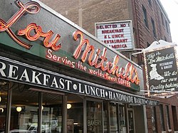 Retro roadside
 Museum
 Museum
 Museum
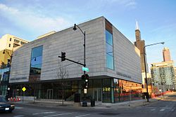 Museum
 Museum
 Museum
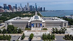 Museum
 Museum
.jpg/250px-Samuel_Nickerson_House_(7362726240).jpg) Museum
Museum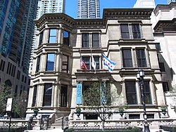 Museum
 Museum
.jpg/250px-Chicago_Water_Tower_(October_2008).jpg) Art & landmarks
Art & landmarks Museum
 Museum
 Art & landmarks
 Museum
 Art & landmarks
 Museum
 Museum
 Museum
 Nature & parks
 Nature & parks
.jpg/250px-ChicagoNature_(6).jpg) Museum
Museum- Archaeology
 Nature & parks
 Museum
- Route 66 site
- Archaeology
- Archaeology
 Museum
.jpg/250px-University_of_Chicago_July_2013_48_(Smart_Museum).jpg) Museum
Museum.jpg/250px-Hyde_Park_Art_Center_(front_door).jpg) Museum
Museum Museum
 Nature & parks
 Museum
- Archaeology
- Archaeology
- Archaeology
 Nature & parks
.jpg/250px-Museum_of_Science_and_Industry_(Chicago).jpg) Museum
Museum_-_Chicago%2C_IL_-_June_2026.jpg/250px-Obama_Center_south_elevation_2_(opening_day)_-_Chicago%2C_IL_-_June_2026.jpg) Museum
Museum Retro roadside
 Historic theater
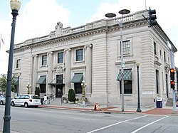 Historic building
 Museum
 Historic hotel
- Ghost town
 Historic building
 Historic building
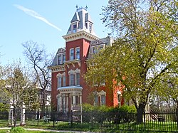 Historic building
 Historic district
.jpg/250px-Slovenian_Women's_Union_(49571798232).jpg) Museum
Museum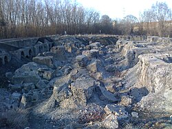 Historic building
 Nature & parks
 Historic district
What this Route 66 map shows
Every dot is one of our 823 stops along Route 66, from the Chicago lakefront to the Pacific at Santa Monica: restored gas stations and neon motels, museums, ghost towns, parks, bridges, old theaters and the roadside giants the road is famous for. The color of a dot tells you the kind of stop, and the line shows the road town by town across all eight states.
Each stop comes with a photo from Wikimedia Commons (with a link to its author and license), how far it sits from the old road, the nearest town and, where we know them, the address, opening hours and whether there are restrooms or food nearby. The line is simplified, so for turn-by-turn driving directions tap Directions on any stop, or send a whole trip to Google Maps from the trip planner.
How to use the map
Tap the kinds of stops you want, such as ghost towns, museums or motels, and pick a state to zoom in. "Restrooms nearby" and "Food nearby" keep only the stops with those close at hand. Tap a dot or a row in the list for a quick look with the photo, then open the full page for the story and practical details. Your filters stay in the address, so a link you share opens the same view.
Found something you like? Tap the heart to save it. Saved stops go into My trip, which puts them in driving order, adds the miles between them and opens the route in Google Maps. For a printable Route 66 map of your own trip, plan it in the trip planner and use Print or Save as PDF.
Route 66 by state
| State | Miles | Stops |
|---|---|---|
| Route 66 in Illinois | 300 | 213 |
| Route 66 in Missouri | 315 | 124 |
| Route 66 in Kansas | 13 | 8 |
| Route 66 in Oklahoma | 400 | 100 |
| Route 66 in Texas | 180 | 15 |
| Route 66 in New Mexico | 380 | 67 |
| Route 66 in Arizona | 400 | 114 |
| Route 66 in California | 315 | 182 |
Miles are rounded (about) and depend on the alignment you drive; stops are the places on our map; the whole road is about 2,448 miles. New Mexico is the post-1937 line; the older loop through Santa Fe added about 100 miles.
Route 66 towns, east to west
All 47 towns on our map, grouped by state in driving order. Tap one to see its stops.
Illinois · 6 towns
Kansas · 1 town
New Mexico · 5 towns
Route 66 stops by kind
Route 66 map: questions
How long is Route 66?
About 2,448 miles, from Chicago, Illinois to Santa Monica, California, across eight states. The exact length depends on which alignment you follow, because the road was moved and straightened many times between 1926 and the 1980s.
Where does Route 66 start and end?
It starts in downtown Chicago, on Adams Street near Michigan Avenue and the Art Institute, and ends in Santa Monica, California, where the traditional finish is the Santa Monica Pier on the Pacific.
What states does Route 66 go through?
Eight, from east to west: Illinois, Missouri, Kansas, Oklahoma, Texas, New Mexico, Arizona and California. Kansas has the shortest stretch, about 13 miles; Oklahoma, New Mexico and Arizona have the longest.
Can you still drive Route 66?
Yes, for most of the way. Route 66 was removed from the U.S. highway system in 1985, but long stretches survive as state highways, frontage roads and city streets signed "Historic Route 66", running beside I-55, I-44 and I-40. A few pieces are gravel, closed or gone under the interstate.
How long does it take to drive Route 66?
About two weeks for the whole road at an easy pace of around 175 miles a day, with time for stops. Ten days is possible if you hurry, and three weeks leaves room for museums and side trips like the Grand Canyon. The trip planner splits any stretch into days for you.
What is the most famous stop on Route 66?
There is no single answer, but many drivers would name Cadillac Ranch in Amarillo, the Blue Whale of Catoosa, the Wigwam Motel in Holbrook or the Gemini Giant in Wilmington. All four are among the 40 classic icons in our 823 stops.