Route 66 in St. Louis, Missouri
St. Louis is where Route 66 crosses the Mississippi River, about 327 miles from Chicago. The stops we group under St. Louis spread over both banks: the Illinois side around Edwardsville and the Cahokia mounds, the city itself, and the old road's path southwest toward Eureka and Pacific.
- About mile 327 of 2,448 from Chicago
- 59 stops in and around St. Louis
- Main overnight town
Tap a dot to see that stop here.
Tap a dot for the photo and a link to the stop (the fork-and-knife markers are places to eat). Open St. Louis on the full map to filter by kind or add stops to your trip.
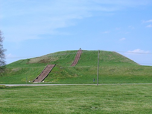
Two river landmarks lead the list. The Chain of Rocks Bridge, with its sharp bend in the middle, once carried Route 66 over the Mississippi and is now open to walkers. Downtown, the 630-foot Gateway Arch is the tallest arch on Earth and the symbol of the city. Across the river, Cahokia preserves the mounds of the largest ancient city north of Mexico.
West of the city, Route 66 history turns bittersweet. The streamlined Coral Court Motel was demolished in 1995 despite a fight to save it, and the town of Times Beach was emptied by dioxin in 1983; its land is now Route 66 State Park. Further on, the Red Cedar Inn in Pacific, a 1930s log roadhouse that fed Route 66 travelers, now serves as a visitor center.
In between there is plenty for a rest day: the Missouri Botanical Garden, founded in 1859, the Saint Louis Zoo in Forest Park with no general admission fee, and the City Museum, built from salvaged building parts inside an old shoe company building. Parks and nature areas make up the biggest share of our stops here, followed by museums and archaeological sites.
Practical note: St. Louis is a main overnight town on our planner, and the city's sights are spread out, so plan to drive between them. Cuba, the next town west, is about 82 miles on.
Top 10 Route 66 attractions in and around St. Louis
Retro roadside (2)
See all Retro roadside on Route 66 →

Historic bridges (1)
See all Historic bridges on Route 66 →
Art & landmarks (5)
See all Art & landmarks on Route 66 →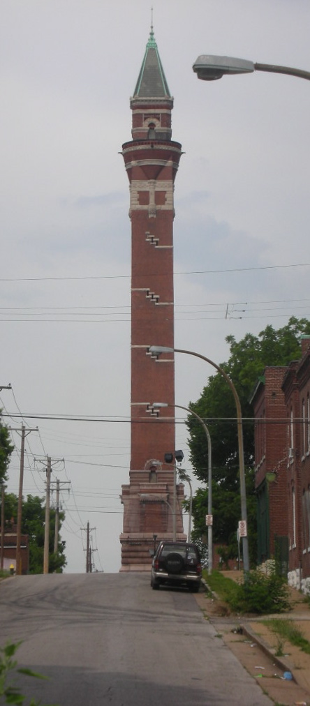
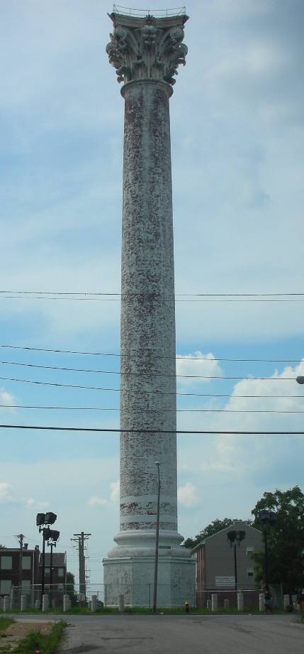


Nature & parks (20)
See all Nature & parks on Route 66 →


Ghost towns (4)
See all Ghost towns on Route 66 →
Historic hotels (1)
See all Historic hotels on Route 66 →
Museums (13)
See all Museums on Route 66 →


.jpg)


Historic districts (2)
See all Historic districts on Route 66 →
_and_Ralph_Griffin_(705)_Houses.jpg/500px-E.M.West_(627)_and_Ralph_Griffin_(705)_Houses.jpg)
Historic buildings (4)
See all Historic buildings on Route 66 →


.JPG/500px-Benjamin_Stephenson_House_(front).JPG)
Archaeology (7)
See all Archaeology on Route 66 →



Where to eat in and around St. Louis
All diners on Route 66 →

Next towns on Route 66
Route 66 in St. Louis: questions
- Did Route 66 go through St. Louis?
- Yes. Route 66 crossed the Mississippi into St. Louis and ran through the city before heading southwest toward Eureka and Pacific. The Chain of Rocks Bridge, now a walking bridge, once carried the highway over the river.
- What is there to see on Route 66 in St. Louis?
- We list 59 stops in and around St. Louis, mostly parks and nature areas, museums and archaeological sites. The ones our trip planner rates highest are Chain of Rocks Bridge, Gateway Arch and Route 66 State Park. Every stop is on the map above with a photo where one exists, and the distance from the old road.
- How far is St. Louis from the next towns on Route 66?
- St. Louis sits at about mile 327 of Route 66, counting from Chicago. The next town east with its own guide is Springfield, IL, about 111 miles back. Heading west, Cuba, MO is about 82 miles on. Distances are measured along the road and rounded.
- Is St. Louis a good place to stay overnight on Route 66?
- Yes. Our trip planner uses St. Louis as one of its main overnight towns, so on a two-week trip a day often ends here. Plan the stops in town for the evening or the next morning.